
Frequently Asked Questions
Learn more about the Magalloway Lands & Waters Project, including conservation outcomes, public access, recreation, land ownership, stewardship, and what permanent protection means for the future of this special place.
If you still can’t find the answer you’re looking for, please contact one of the Magalloway Collaborative organizations directly.
Rangeley Lakes Heritage Trust (RLHT)
(207) 864-7311 | info@rlht.org
Forest Society of Maine (FSM)
(207) 945-9200 | info@fsmaine.org
Northeast Wilderness Trust (NEWT)
(802) 224-1000 | info@newildernesstrust.org
The Nature Conservancy in Maine (TNC)
(207) 729-5181 | naturemaine@tnc.org
About the Project
The Magalloway Conservation Collaborative is a partnership of four conservation organizations (Rangeley Lakes Heritage Trust, Forest Society of Maine, Northeast Wilderness Trust, and The Nature Conservancy in Maine) that worked together to conserve 78,000 acres for a variety of conservation purposes, including wildlife habitat protection and restoration, climate change mitigation, sustainable forestry, recreational and cultural access.
The Magalloway lands & waters project conserves more than 78,000 acres in the remote, unorganized territories of Oxford County in western Maine, along the Maine–New Hampshire border.
The conserved landscape extends from Route 16 and Aziscohos Lake in the south, follows the Magalloway River north through Parmachenee Lake, and reaches the high peaks of Ledge Ridge and Rump Mountain near Bowmantown Township, just south of the Québec border. Explore project maps or take a virtual journey with the Visiting Magalloway story map.
- Ownership outcomes are outlined in this project map. Approximately 62,500 acres are owned by Bayroot, LLC, and managed for timber harvesting by Wagner Forest Management. Forest Society of Maine holds a conservation easement on all of this acreage, ensuring that sustainable forestry can continue, while restricting future development. This conservation easement ensures that the current landowner, and any future landowner, comply with these terms. (Shown in green on the map).
- Northeast Wilderness Trust owns 11,200 acres (brown on the map) as a wilderness preserve.
- Rangeley Lakes Heritage Trust owns 4,400 acres (orange on the map) surrounding the main stem of the Magalloway River and Little Magalloway, several islands on the northern end of Aziscohos Lake, as well as a parcel to the south connecting to Cupsuptic Lake.
- There are a number of private inholdings and lease sites not included in this conservation transaction (white areas on the map).

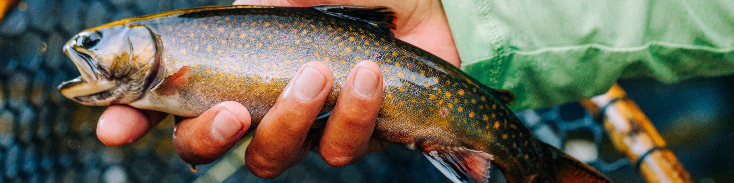
The Magalloway region has a storied history of world-renowned native brook trout fishing and outdoor recreation, as well as significant contributions to the regional timber economy. In recognition of this unique property’s scenic, ecological, recreational and economic value, the Magalloway Collaborative joined forces to create conservation on the land.
This 78,000-acre parcel is centrally located within a corridor that, now complete, creates a contiguous forest of over 500,000 acres spanning from Maine to New Hampshire and north into Quebec. Ecological connectivity supports biodiversity by allowing wildlife to move freely to adapt to a changing climate. People also benefit from the recreational and scenic values of large, contiguous natural areas. Connected ecosystems are better able to function overall, and in turn continue to provide services that support human health and quality of life.
Public Access: Roads, Gates & Parking
One of the most significant outcomes of the Magalloway lands & waters project is the protection of public access. Rather than risking the loss or fragmentation of access over time, this conservation effort ensures future generations can continue to experience this remarkable landscape through traditional recreational uses. Rather than risking the loss or fragmentation of access over time, this conservation effort ensures future generations can continue to experience this remarkable landscape through traditional recreational uses. For more information on laws, rules, and best practices for access in Maine:
https://www.maine.gov/ifw/hunting-trapping/hunting/laws-rules/private-property.html
It’s important to remember these lands are very remote and can be difficult to reach depending on road conditions. Safe travel to the area requires high vehicle clearance, good tires, including spares, and the ability to repair your vehicle without help. There is limited to no cell phone coverage and no facilities.
Before your visit, bring a paper map, fuel up, and be prepared to travel without reliable cell service. When driving on logging roads, keep your headlights on, yield to logging trucks, and follow posted safety signs and road conditions. Learn more by visiting our Know Before You Go page.
The conservation of these lands and waters ensures that existing recreational access will continue on the majority of the lands. This includes fishing, paddling, hunting, snowmobiling, birdwatching and more. Knowing where you are going and checking for information on each landowner’s website will provide the best information about recreational opportunities.
First and foremost, please refer to updated regulations from the Maine Department of Inland Fisheries and Wildlife for current information:
Fishing: https://www.maine.gov/ifw/fishing-boating/fishing/laws-rules/statewide-laws.html
Hunting: https://www.maine.gov/ifw/hunting-trapping/hunting/laws-rules/index.html
Trapping: https://www.maine.gov/ifw/hunting-trapping/trapping/laws-rules/index.html
Fishing
Fishing is allowed throughout the various lands, subject to MDIFW fishing regulations. The Magalloway River is designated fly fishing only with the use of barbless hooks. Refer to Maine Department of Inland Fisheries & Wildlife fishing regulations.
Hunting and Trapping
All legal forms of hunting as permitted by state law are allowed within the conservation easement area held by FSM and on RLHT’s fee-owned lands. On NEWT’s wilderness preserve in the north of the property, hunting is permitted with some restrictions, and trapping is prohibited. Please refer to NEWT’s hunting policy page for more details and to complete a permission form. Please adhere to MDIFW regulations and check landowner websites for details. Check each landowner’s website for details and always KNOW WHOSE LAND YOU ARE ON.
Northeast Wilderness Trust: https://newildernesstrust.org/wilderness-conservation/hunting-and-fishing/
Rangeley Lakes Heritage Trust: https://rlht.org/conservation-area/land-use-faqs/
Forest Society of Maine Conservation Easement lands (Wagner Forest Management): https://www.wagnerforest.com/community-involvement/recreation/
The northern third of the area surrounding Parmachenee Lake is, and has been for more than 50 years, limited by gates that do not permit vehicular access. Foot travel continues to be permitted.
No. Vehicular access on the northern third of the project area remains limited by gates that the landowner has maintained for decades.
There are no parking lots in the project area. Visitors should park in safe areas outside of the travelled way, fully clear of roads (logging trucks have the right of way and may be travelling at any time of day or night) and clear of all gates. Be aware that road conditions are subject to change (once passable bridges may be impassable, etc.). Use caution.
No. The use of motorized and mechanized vehicles (including ATV’s, dirt bikes, bicycles, etc.) on these properties is prohibited.
Recreational users may still hire Registered Maine Guides for activities including hunting, fishing, and wildlife viewing.
In the winter, snowmobiling remains a welcomed activity on established trails through the property, with the ITS-84 connecting Maine and New Hampshire — continuing in use.
Boating access to the majority of the lakes and streams across the property continues, including a put-in on Aziscohos Lake and many opportunities for hand-carry access, including on the Magalloway River.
There are numerous camping opportunities close to the Magalloway region. We recommend checking out Black Brook Cove, Aziscoos Valley Camping Area or the Cupsuptic Lake Park & Campground.
- RLHT is currently looking at opportunities for future campsites on Aziscohos Lake islands. Nothing has been finalized yet. Please contact RLHT for more information: info@rlht.org.
- See newildernesstrust.org for usage guidelines on the Northeast Wilderness Trust wilderness preserve.
- Across the greater conservation easement held by FSM and managed by Wagner, camping is not permitted. See Wagner’s recreation guidelines for more info.
The entire project area sits within the Unorganized Territory of Maine, and the net effect of the entire project on tax payments to the state is expected to be minimal. Forestland retained by Bayroot, LLC, has been and will continue to be, enrolled in the Maine Tree Growth Tax Program. Northeast Wilderness Trust will be making payments in lieu of taxes to the state that are approximately equivalent to the open space taxation rate for non-managed forestland. Rangeley Lakes Heritage Trust will be taking a similar approach.
Donations
No, it’s not too late to donate. While we have secured commitments to meet 100% of our fundraising goal, you can support the ongoing stewardship of the lands and waters of the Magalloway. If you wish to contribute, visit this page.
You can still mail a donation by writing “Magalloway” in the memo line of your check. Please mail to this address:
Rangeley Lakes Heritage Trust
2424 Main Street
Rangeley, Maine 04970
Yes. Donations made in support of the Magalloway Lands & Waters Project are tax-deductible to the fullest extent allowed by law. Gifts are processed by Rangeley Lakes Heritage Trust, a nonprofit, tax-exempt organization under Section 501(c)(3) of the Internal Revenue Code.